 CIT Tools
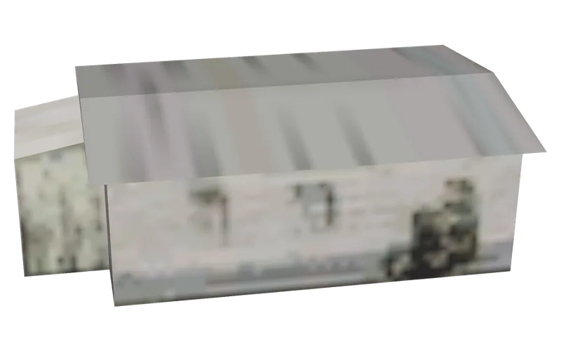
3299lod_conhoos3
Blurry white building with grey roof.
- Object ID
- 3299
- Model name
lod_conhoos3- Texture file (TXD)
lod_cxrefhooses- Draw distance
- 450
- Defined in
counxref.ide- Flags
128- Placed in the world
- 14 times
- Size
- 12 m long, 7.5 m wide, 3.8 m high
MTA:SA code
Copy a line into your script. The lines use the first place the game puts this object. Removing a world model does not remove its occlusions, so nearby parts of the map can disappear; the MTA wiki suggests setOcclusionsEnabled(false).
local obj = createObject(3299, -1518.03, 2698.59, 55.21)removeWorldModel(3299, 10, -1518.03, 2698.59, 55.21) -- removes the one at El Quebrados, Tierra RobadaengineGetModelNameFromID(3299) -- "lod_conhoos3" (client side)Where the game places it
X, Y and Z of each place, with the zone name the game gives it. Map opens the coordinates map on that spot.
| X | Y | Z | Zone | |
|---|---|---|---|---|
| -1518.03 | 2698.59 | 55.21 | El Quebrados, Tierra Robada | Map |
| -314.19 | 2720.64 | 62.21 | Las Payasadas, Bone County | Map |
| -195.6 | 2768.76 | 61.48 | Las Payasadas, Bone County | Map |
| -89.12 | 936 | 19.76 | Fort Carson, Bone County | Map |
| -15.55 | 968.73 | 18.92 | Fort Carson, Bone County | Map |
| 64.28 | 976.8 | 14.81 | Fort Carson, Bone County | Map |
| 302.43 | 44.05 | 2.23 | Blueberry, Red County | Map |
| 1404.53 | 351.62 | 18.39 | Montgomery, Red County | Map |
| 1446.89 | 380.49 | 18.54 | Montgomery, Red County | Map |
| 2466.29 | -959.2 | 79.66 | Las Colinas, Los Santos | Map |
| 2493.39 | -944.15 | 81.61 | Los Santos | Map |
| 2494.95 | -959.63 | 81.69 | Las Colinas, Los Santos | Map |
| 2523.51 | -1066.91 | 69.11 | Las Colinas, Los Santos | Map |
| 2564.96 | -1028.24 | 69.01 | Las Colinas, Los Santos | Map |
A far-away model for
This is a low-detail (LOD) model: the game draws it from far away instead of these 4 models.


Same texture file
10 other objects use lod_cxrefhooses.
 3297lod_conhoos1
 3298lod_conhoos2
 3300lod_conhoos4
 3301lod_conhoos5
 3357cxrf_lod_savhs1_
 3358cxrf_lod_savhs2_
 3360cxrf_lod_savg_
 3371lod_d_bighus1_
 3372lod_d_bighus2_
 3373lod_d_bighus3_
Countryside and desert · All objects, page 22 · Search all 14,259 objects · Coordinates map
Where this comes from
- GTA San Andreas counxref.ide (the definition), the map IPL files and the stream IPLs in gta3.img (the places), and info.zon (zone names), read from an installed copy of the game. The file list is the game's own gta.dat.
- The picture: drawn on 3 October 2026 from this model and its texture file in an installed copy of the game. It is lit plainly and the shade the model stores is brightened, so the game can show it darker; the camera looks at the side with the most to see. Only the picture is hosted, not the model or its textures.
- What it is, in a few words: written from the picture by Claude and checked against it; shown only where the words were marked sure.
- The size: the model's own bounding box as stored in the game file, measured when the picture was drawn: the longest side, the other side along the ground, and the height. The game can place the model turned.
- MTA wiki: createObject
- MTA wiki: removeWorldModel
- MTA wiki: engineGetModelNameFromID
Checked on 29 September 2026.