 CIT Tools
775Elmwee_hi
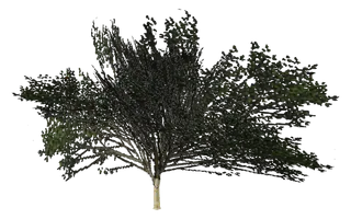
Dark green leafy tree with curved pale trunk.

- Object ID
- 775
- Model name
Elmwee_hi- Texture file (TXD)
tree2- Draw distance
- 150
- Defined in
vegepart.ide- Flags
2097156- Placed in the world
- 22 times
- Size
- 18 m long, 11 m wide, 16 m high
MTA:SA code
Copy a line into your script. The lines use the first place the game puts this object. Removing a world model does not remove its occlusions, so nearby parts of the map can disappear; the MTA wiki suggests setOcclusionsEnabled(false).
local obj = createObject(775, -2211.42, -2393.95, 29.99)removeWorldModel(775, 10, -2211.42, -2393.95, 29.99) -- removes the one at Angel Pine, WhetstoneengineGetModelNameFromID(775) -- "Elmwee_hi" (client side)Where the game places it
X, Y and Z of each place, with the zone name the game gives it. Map opens the coordinates map on that spot.
| X | Y | Z | Zone | |
|---|---|---|---|---|
| -2211.42 | -2393.95 | 29.99 | Angel Pine, Whetstone | Map |
| -2210.1 | -2442.05 | 29.63 | Angel Pine, Whetstone | Map |
| -2179.64 | -2483.08 | 29.56 | Angel Pine, Whetstone | Map |
| -2173.8 | -2487.47 | 29.56 | Angel Pine, Whetstone | Map |
| -2004.88 | -2557.48 | 37.53 | Angel Pine, Whetstone | Map |
| -2003.5 | -2534.24 | 34.55 | Angel Pine, Whetstone | Map |
| -2002.22 | -2548.48 | 36.61 | Angel Pine, Whetstone | Map |
| -2001.39 | -2606.13 | 59.52 | Whetstone | Map |
| -1996.73 | -2541.16 | 34.55 | Angel Pine, Whetstone | Map |
| -1996.48 | -2631.47 | 58.2 | Whetstone | Map |
| -1983.54 | -2621.8 | 60.25 | Whetstone | Map |
| -1981.79 | -2601.03 | 60.45 | Whetstone | Map |
| 1186.43 | 135.05 | 23.09 | Montgomery, Red County | Map |
| 1196.51 | 214.33 | 18.65 | Montgomery, Red County | Map |
| 1199.52 | 733.87 | 9.66 | Las Venturas | Map |
| 1203.5 | 202.61 | 18.65 | Montgomery, Red County | Map |
| 1210.16 | 127.18 | 21.02 | Montgomery, Red County | Map |
| 1226.9 | 123.86 | 19.57 | Montgomery, Red County | Map |
| 1301.27 | 164.27 | 19.35 | Montgomery, Red County | Map |
| 1434.75 | 210.84 | 17.9 | Montgomery, Red County | Map |
| 1440.55 | 225.3 | 18.12 | Montgomery, Red County | Map |
| 1445.16 | 237.18 | 18.16 | Montgomery, Red County | Map |
Same texture file
7 other objects use tree2.


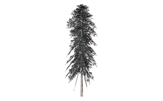


Looks like
Objects of the same list whose picture words match this one's.



Game file: vegepart · All objects, page 2 · Search all 14,259 objects · Coordinates map
Where this comes from
- GTA San Andreas vegepart.ide (the definition), the map IPL files and the stream IPLs in gta3.img (the places), and info.zon (zone names), read from an installed copy of the game. The file list is the game's own gta.dat.
- The picture: drawn on 3 October 2026 from this model and its texture file in an installed copy of the game. It is lit plainly and the shade the model stores is brightened, so the game can show it darker; the camera looks at the side with the most to see. Only the picture is hosted, not the model or its textures.
- What it is, in a few words: written from the picture by Claude and checked against it; shown only where the words were marked sure.
- The size: the model's own bounding box as stored in the game file, measured when the picture was drawn: the longest side, the other side along the ground, and the height. The game can place the model turned.
- Looks like: the objects of the same list that share two or more of this one's picture words (colours and sizes not counted).
- MTA wiki: createObject
- MTA wiki: removeWorldModel
- MTA wiki: engineGetModelNameFromID
Checked on 29 September 2026.